More winter weather for the region

City roads update
read more

More winter weather for the region

Hannon says crews are focusing on the interstate and primary roads. It’s slippery. Stay home if you can. Road conditions at 511virginia.org

Snow expected to begin by early afternoon. A little sleet and freezing rain too

Crews will mobilize at midnight in anticipation for the Sunday storm. Roads have been pretreated. Tow trucks are in place along I-95.

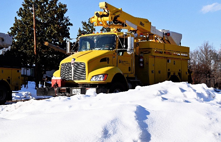
Removal of trees and debris from past winter storm will take several months to complete; Crews will prioritize I-95 and primary routes before shifting to secondary roads

Prepare right now for Sunday’s winter weather. REC’s Casey Hollins with some great ideas

The National Weather Service says snow will begin late morning. A little ice expected. Rain by evening tomorrow

Right now, the heaviest snow is predicted to the west of the Fredericksburg area

Are you ready at home for our next storm this weekend?

Snow expected to begin Sunday afternoon

Crews pre-treated I-95 in the Fredericksburg area, several primary routes in Northern Neck and Middle Peninsula areas

Still too early to know how much snow or rain we’ll receive

Crews will apply a salt brine solution on major routes to reduce icing with potential of snow
Here are some of the things you need to know before you lose the power

About 100 customers to go!

Finally…we should see some more of the snow melt this afternoon
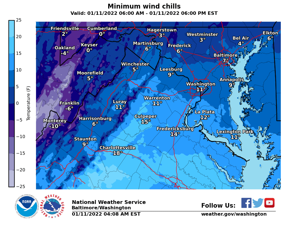
The National Weather Service says winds diminish late today, but not before wind chills end up in the single digits for many this morning. Turning milder tomorrow.

There are still more than 310 separate outage events

An update on restoration efforts and how to prepare for when the power returns and how to slowly reheat your home

The National Weather Service says wind chills for many will be in the teens, with highs barely above freezing and winds gusting over 30 mph.
Today’s News Sponsored by:


