Dangerous heat over the next few days. Here are some tips for staying safe

Rappahannock Area Health District tips for staying cool during these hot days
read more

Dangerous heat over the next few days. Here are some tips for staying safe

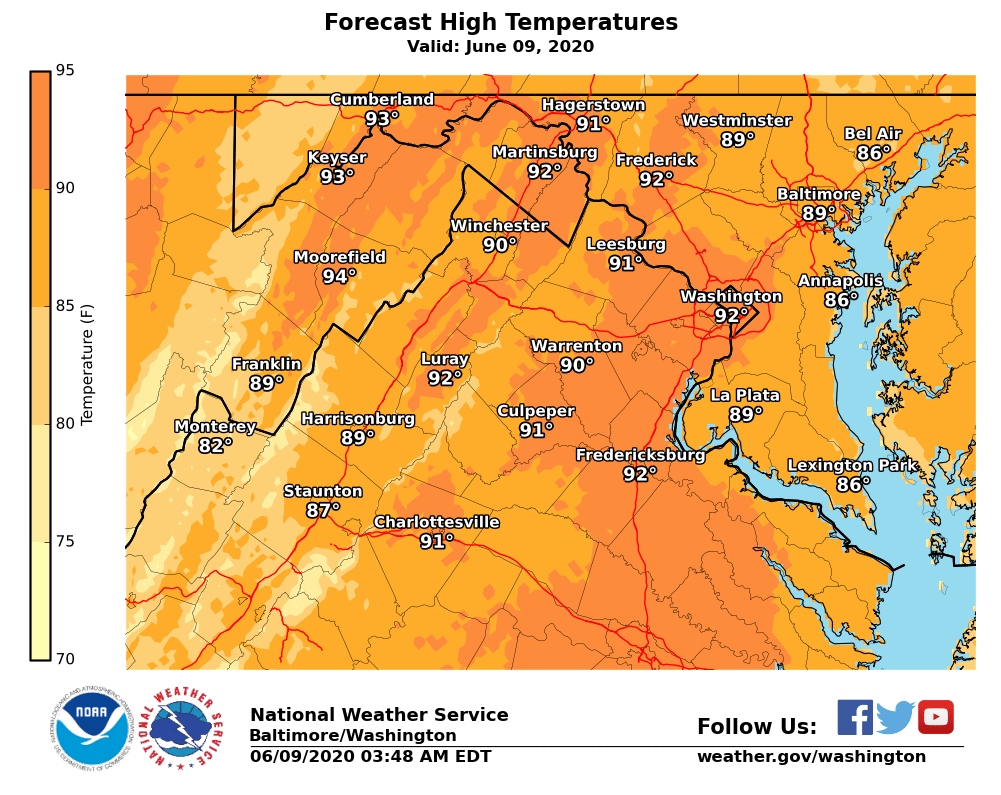
The National Weather Service says temperatures today will run 5 to 10°F above normal for the middle of July as much of the area remains on the dry side. Forecasters say with increasing temperatures and humidity the next several days, be sure to practice heat safety wherever you are.

The National Weather Service says today is the start of high heat and humidity

The National Weather Service says continued hot and humid conditions today. Isolated to scattered showers and storms this afternoon and early evening in Northern Virginia.

The National Weather Service says another hot and humid day today. Afternoon showers and thunderstorms are expected as well. Some of these storms could be strong to severe, with damaging winds, large hail, and an isolated threat for flooding.

The National Weather Service says today will be the hottest day of the year thus far. Remember to practice heat safety and stay hydrated if spending time outside.

The National Weather Service says showers and thunderstorms are expected today, especially after noon. A few storms could be strong to severe, with damaging winds being the main threat.

The Weather Channel says the midwest will be real hot in July. We’ll be above average.

Temps near 100 with high humidity and possible storms today

The National Weather Service says the region could see storms later today

The National Weather Service says it will be cool for this time of year along with low humidity. A few showers are possible across central Virginia and southern Maryland.

The National Weather Service says hot and humid this afternoon, with heat index values in many areas in the upper 90s to low 100s. Additionally, severe storms possible this afternoon
The National Weather Service says after a few days in the 80’s, we’re back into the 90’s

VIDEO: Out with the heat and humidity–in with sunshine and cooler temps on Sunday!

The National Weather Service says an approaching cold front will bring the chance for strong to severe thunderstorms this afternoon/evening, capable of producing large hail and damaging winds. Severe threat is best north and west of I-95

The National Weather Service says we could see some breaks in clouds this afternoon, which could allow for some thunderstorms to develop. A few of these could become severe, with isolated damaging winds gusts being the main threat.
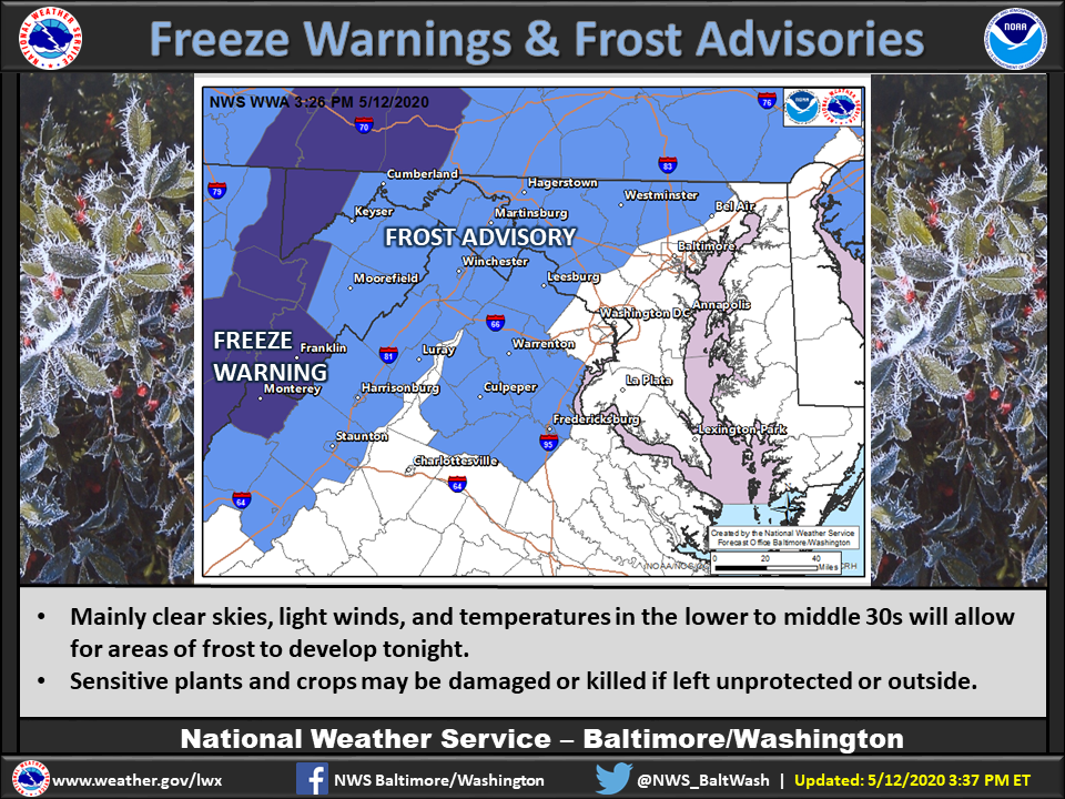
PHOTO: We could see frost early morning…

The National Weather Service says next weekend we could see temperatures in the mid-80’s

It will feel more like March than May this weekend. Freeze potential is concentrated in areas west of DC tonight thanks to a gusty wind, but may be more widespread Saturday night as light winds, clear skies and dry air allow temps to plummet.

The National Weather Service says we’ll see rain today. Most of it comes tonight
Today’s News Sponsored by:


