VIDEO: Clouds and rain turned to wind and sun in region on Sunday.

Clouds2Sun on Sunday
read more

VIDEO: Clouds and rain turned to wind and sun in region on Sunday.

Spring really kicks in today and tomorrow. Temperatures in the mid-70’s.. Cooler and wet on Sunday
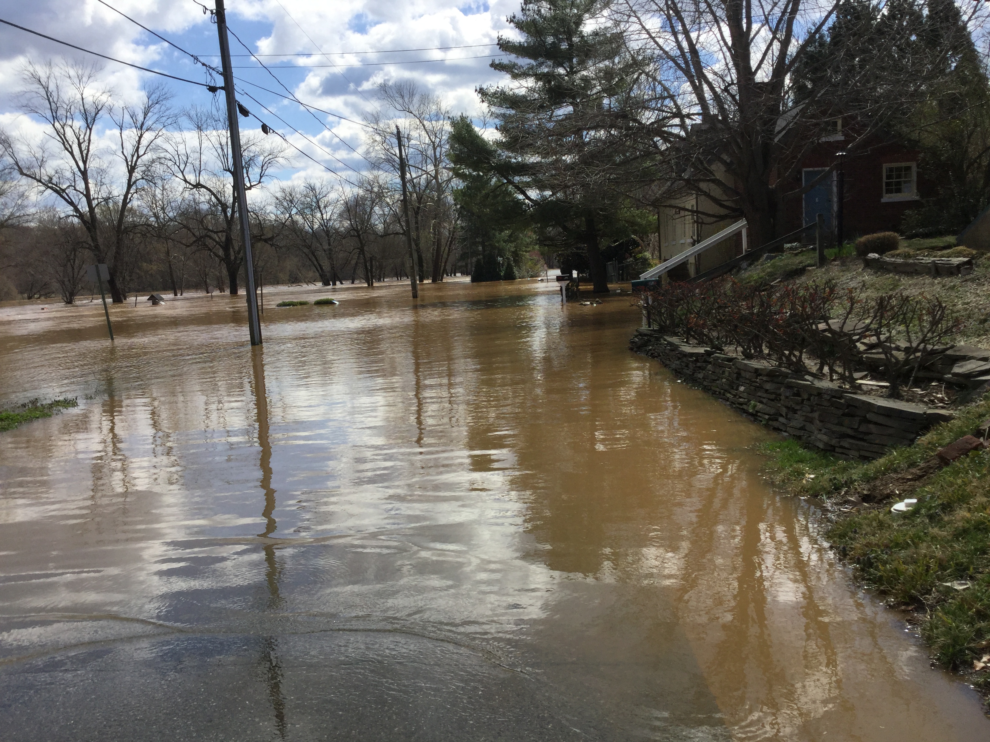
PHOTOS: The results of the heavy rain Thursday here and upstream….

PHOTOS: The results of the heavy rain Thursday here and upstream….

National Weather Service predicts Rappahannock will crest at City Dock at 13.8 feet. Flood stage is 13 feet

The National Weather Service says we’ll see a soaking rain today

PHOTOS: All kinds of nature this afternoon along the canal trail in the city.
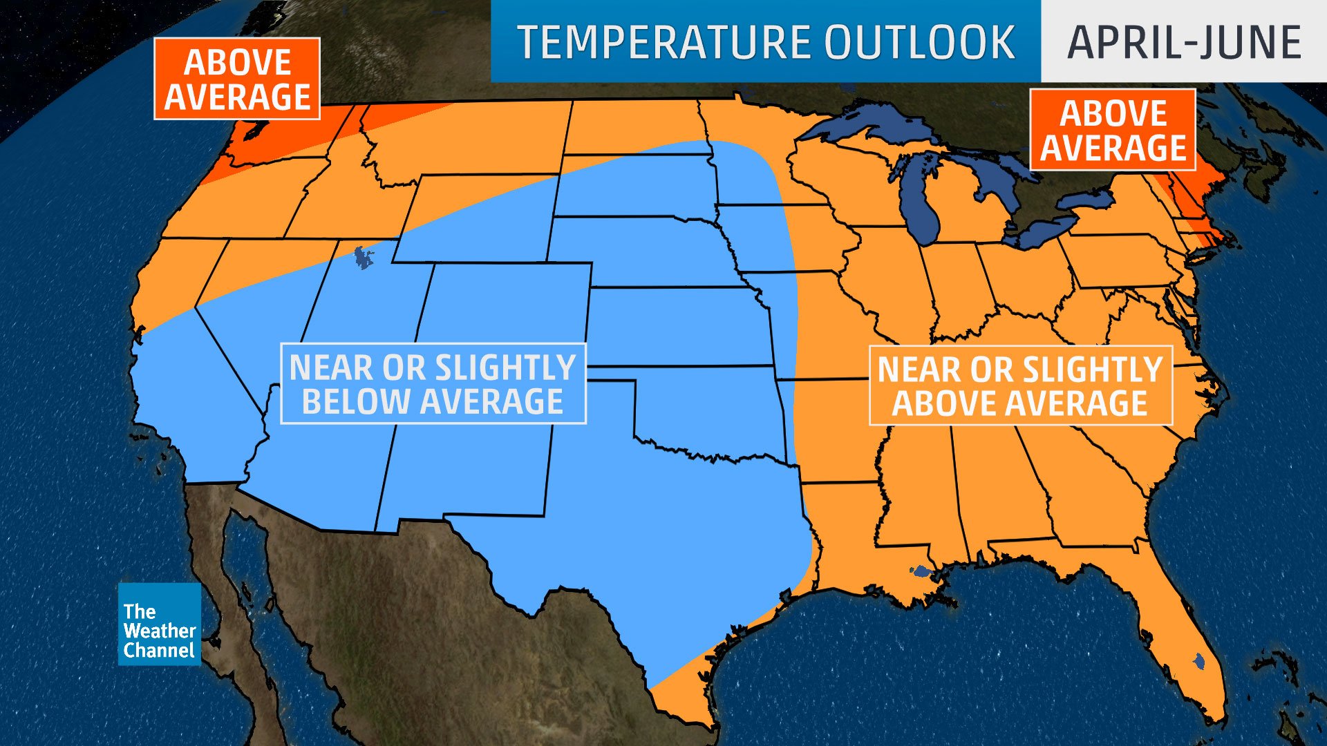
A three month weather map shows temps for the region to be near or slightly above average

Virginia’s annual statewide tornado drill is coming up tomorrow morning.

It has already been an active severe weather season in US. It’s just over a week until the Virginia statewide tornado drill. Be prepared. Register to participate in this year’s drill Tuesday, March 19th at 9:45 am

The National Weather Service says you’ll notice a big change in temperatures today. It will be nearly 70 around the region! Forecasters say it will be cloudy.

VIDEO: With temperatures next week in the 50’s and 60’s—was the Friday snow our last of the season?

It’s cold this morning as gusty winds combine with arctic air.

Rappahannock Electric Cooperative worked through the night to restore service to most members who lost power during yesterday’s winter storm. As of 10 a.m., fewer than 400 members remained without power – down from a peak of more than 4,000 outages last night.

The National Weather Service has slightly lowered our projected snow totals today…

The National Weather Service says Winter Storm Warnings posted for much of the region to the north and west. In Southern MD/Fredericksburg area, Winter Weather Advisories issued. Expect snow to overspread the area tonight.

Tanker trucks will apply a salt brine solution to Interstate 95 travel lanes and ramps in the Fredericksburg area starting at 8 p.m. Monday

The National Weather Service says a strong low pressure system will impact the area late Tuesday night through Wednesday night. A Winter Storm Watch has been issued for the potential of snow accumulations of 5 or more inches and ice accumulations of a quarter-inch or greater.

The National Weather Service says spring like temperatures are expected today. Snow potential remains late tonight and into the day on Saturday, but the trend has been further south with limited moisture in the region.

The National Weather Service says the main story today is the wind. Gusts will be quite strong, especially in the mountains
Today’s News Sponsored by: